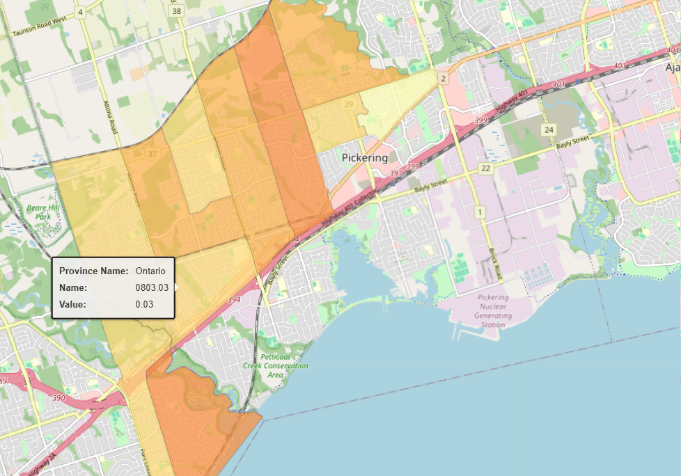
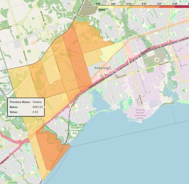
StatCan Data with
Geographical Regions Polygon Boundaries
We transform raw StatCan (Statistics Canada) data into high-quality, ready-to-use datasets designed for seamless integration into your analytics and applications.
Our process goes beyond simple data extraction—we clean, structure, and enrich the data with geographic polygon boundaries, making spatial analysis effortless. Whether you're working with demographics, economic trends, or regional insights, our datasets provide a powerful foundation for data-driven decision-making.
Use cases:
Economic Analysis.
Market Research & Consumer Insights.
Real Estate & Housing Market Analysis.
Workforce & Labor Market Analysis.
Supply Chain & Logistics Optimization.
Demographic & Population Analysis.
Environmental & Climate Change Research.
Health Services Planning & Analysis.
Education & Workforce Development.
Geospatial Analysis.
Datasets: More than 4,000 datasets available (Download Excel or txt file with list of available datasets)
Data Catalog information:
· Geographic Coverage: Canada
· Update Frequency: Every month
· Collection Granularity: Every day
· Data Source: Statistics Canada
To contact us and discuss acquiring our datasets, please email: sales@datalv.io
Our products are available in: Databricks Marketplace
The clarity and ease of use in DataLV’s data catalog have transformed our data handling. It’s made our processes much more efficient!
Alex Smith

DataLV’s comprehensive and easy-to-understand datasets have made our data analysis tasks much simpler and faster.
Jordan Lee
